Surface Roughness from Large-Scale Laser Scanning Point Clouds for Urban Accessibility Analysis
Abstract
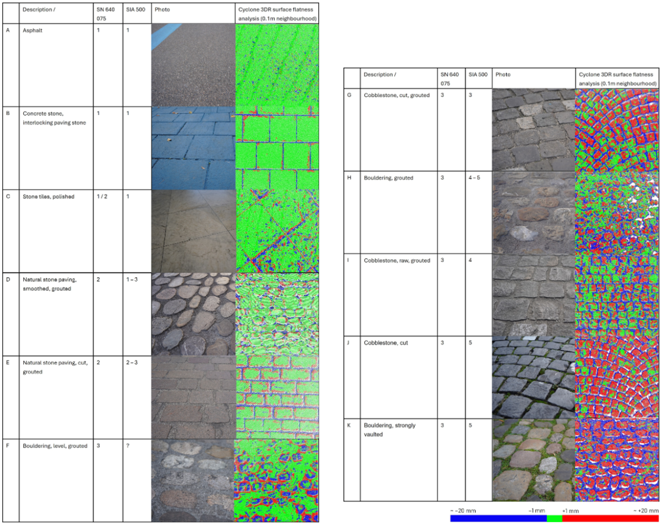
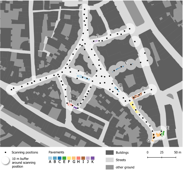
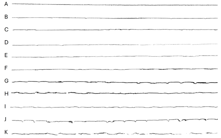
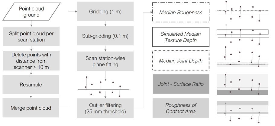
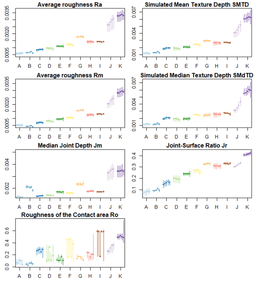
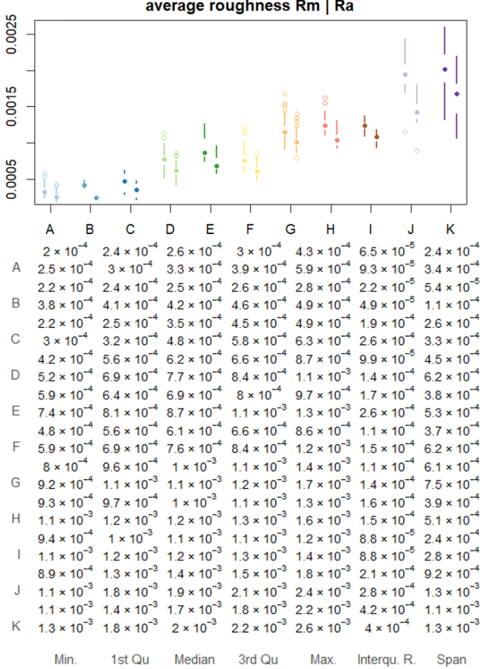
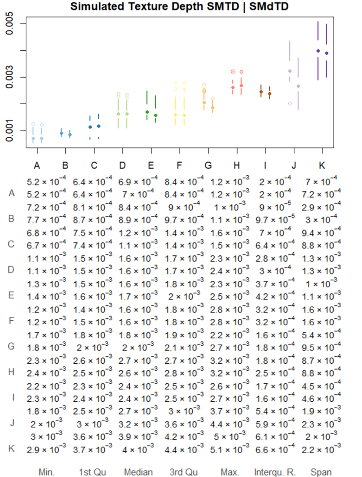
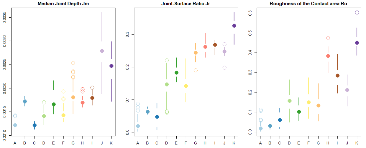
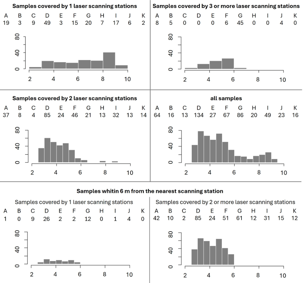
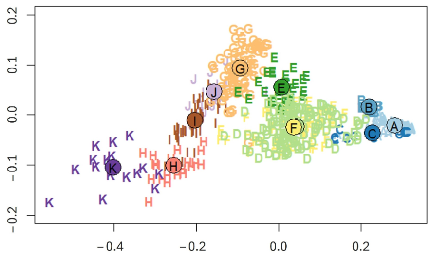
Surface macrotexture is of major interest for barrier-free routing, particularly for wheelchair travellers, because it relates to the functional properties of pavements, such as loss of energy through tyre-rolling resistance or vibrational discomfort. These functional properties are difficult to assess. The measurement and characterization of pavement macrotexture, therefore, is a promising approach to support safe route choice for wheelchair travellers and to provide comparative quality criteria for inclusive urban infrastructure management and planning. We use 3D point clouds from terrestrial laser scanning (TLS) and suggest a set of surface roughness parameters tailored to assess the accessibility of urban pavements at the micro-level. We explore the sensitivity of the parameters to point cloud resampling and apply them to a real-world dataset with eleven different pavements. In spite of value variation related to scanning distance and coverage, our results indicate that combining median-based versions of Average Roughness and Simulated Texture Depth together with parameters tailored to quantify the depth and proportion of joints and the roughness of the contact area facilitates the grouping and comparison of surfaces regarding barrier-free mobility. The results of this work will be integrated into a framework for accessibility analysis and barrier-free routing.
Figures

BibTeX
@article{hollenstein_surfaceRoughnessSmartCities_2026,
 abstract = {Surface macrotexture is of major interest for barrier-free routing, particularly for wheelchair travellers, because it relates to the functional properties of pavements, such as loss of energy through tyre-rolling resistance or vibrational discomfort. These functional properties are difficult to assess. The measurement and characterization of pavement macrotexture, therefore, is a promising approach to support safe route choice for wheelchair travellers and to provide comparative quality criteria for inclusive urban infrastructure management and planning. We use 3D point clouds from terrestrial laser scanning (TLS) and suggest a set of surface roughness parameters tailored to assess the accessibility of urban pavements at the micro-level. We explore the sensitivity of the parameters to point cloud resampling and apply them to a real-world dataset with eleven different pavements. In spite of value variation related to scanning distance and coverage, our results indicate that combining median-based versions of Average Roughness and Simulated Texture Depth together with parameters tailored to quantify the depth and proportion of joints and the roughness of the contact area facilitates the grouping and comparison of surfaces regarding barrier-free mobility. The results of this work will be integrated into a framework for accessibility analysis and barrier-free routing.},
 author = {Hollenstein, Daria and Ammann, Manuela and Grimm, David Eugen and Bleisch, Susanne},
 doi = {10.3390/smartcities9090146},
 journal = {Smart Cities},
 number = {9},
 title = {Surface Roughness from Large-Scale Laser Scanning Point Clouds for Urban Accessibility Analysis},
 url = {https://www.mdpi.com/2624-6511/9/9/146},
 volume = {9},
 year = {2026}
}