Application, Adaption and Validation of the Thermal Urban Normalization Algorithm in a European City
Abstract
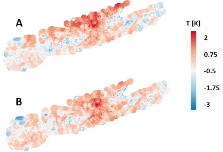
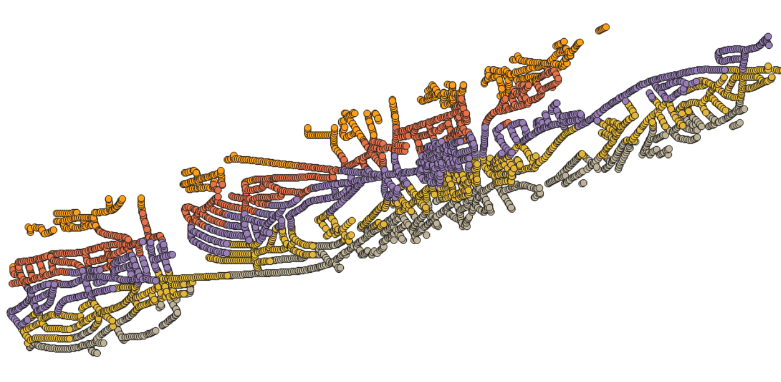
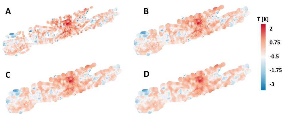
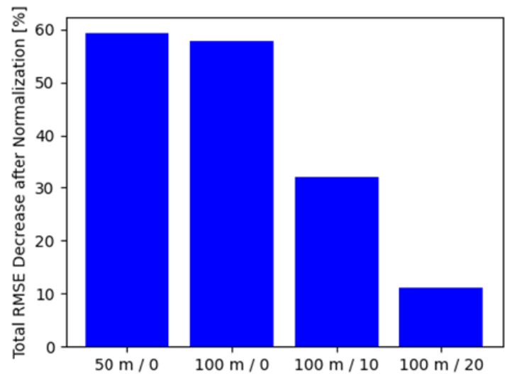
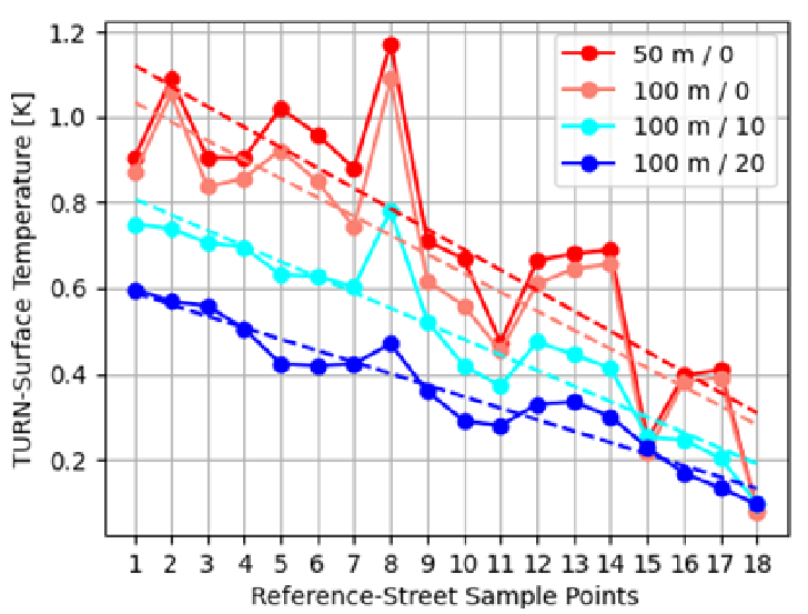
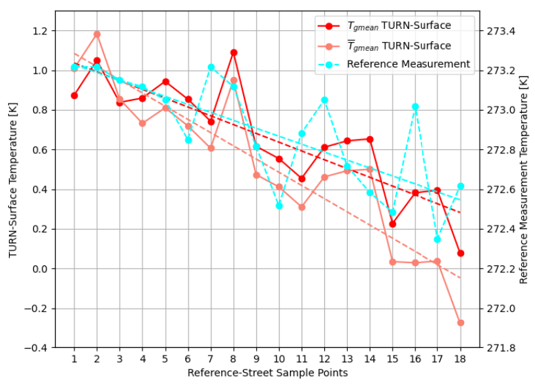
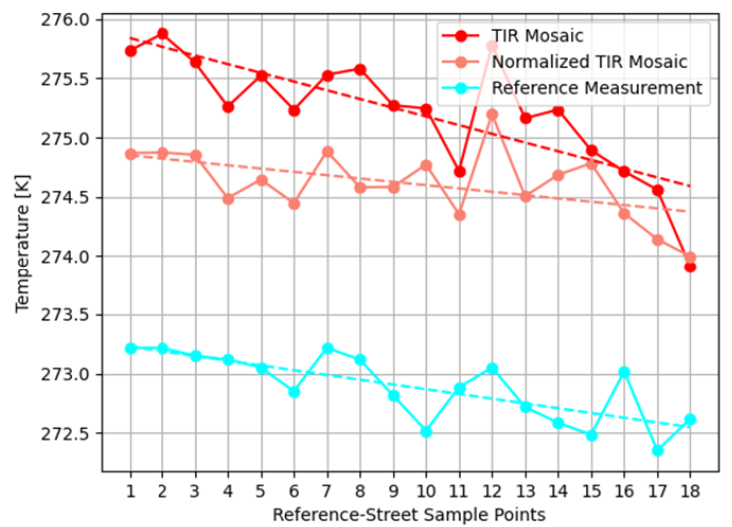
High resolution thermal infrared (TIR) remote sensing in the urban environment for building insulation inspection requires careful consideration of atmospheric and ground-located factors on the radiometric signal, with one being the microclimatic variability within the scene. Based on the assumption of roads as pseudo invariant objects, the TURN algorithm represents a tool to interpolate local temperature deviation within a scene and to normalize TIR-imagery in order to obtain a microclimate-free result. In this work we conduct adjustments, extensions and simplifications to the algorithm when applying it to a Middle-European urban environment. Based on research conducted in Aalen (Germany), we demonstrate our process of applying TURN for TIR-image normalization at high geometric resolutions and a scene composed of multiple adjacent flight-lines. Additionally, radiometric corrections to the TIR-image were applied prior to its processing by the algorithm. The corrections allow a validation of the TURN results by comparing them to ground-based reference data acquired during the flight with convincing agreement.
Figures
BibTeX
@inproceedings{striewski_TURNEnvirVis_2024,
 abstract = {High resolution thermal infrared (TIR) remote sensing in the urban environment for building insulation inspection requires careful consideration of atmospheric and ground-located factors on the radiometric signal, with one being the microclimatic variability within the scene. Based on the assumption of roads as pseudo invariant objects, the TURN algorithm represents a tool to interpolate local temperature deviation within a scene and to normalize TIR-imagery in order to obtain a microclimate-free result. In this work we conduct adjustments, extensions and simplifications to the algorithm when applying it to a Middle-European urban environment. Based on research conducted in Aalen (Germany), we demonstrate our process of applying TURN for TIR-image normalization at high geometric resolutions and a scene composed of multiple adjacent flight-lines. Additionally, radiometric corrections to the TIR-image were applied prior to its processing by the algorithm. The corrections allow a validation of the TURN results by comparing them to ground-based reference data acquired during the flight with convincing agreement.},
 author = {Striewski, Friedrich and Comi, Ennio Luigi. and Tiefenbacher, Fiona and Lack, Natalie and Battaglia, Mattia and Bleisch, Susanne},
 booktitle = {Workshop on Visualisation in Environmental Sciences (EnvirVis)},
 doi = {10.2312/envirvis.20241135},
 editor = {Dutta, S., Feige, K., Rink, Nsonga, B.},
 publisher = {The Eurographics Association},
 title = {Application, Adaption and Validation of the Thermal Urban Normalization Algorithm in a European City},
 url = {https://doi.org/10.2312/envirvis.20241135},
 year = {2024}
}